Welcome to my rambling effort to convey some of my many memories of flying aeroplanes around PNG. As for all new arrivals in the country, I faced a steep learning curve relating to the people, the culture, the way of life – and, above all, flying to survive each trip!

I thought that, rather than ramble on with narratives, it would be better to show some of my memories in photos. One picture tells a thousand words – only much more colourfully. Most of the photos herein originate in the years “BC” (Before Cyberspace). Thus, most of the photos are the result of images captured using real film in real cameras, which had to be scanned into digital form and, as that only happened many years after the recorded events, photo quality had suffered a bit in the intervening years, so many images aren’t quite as sharp as I’d have hoped.
Still, I think they convey a sense of realism and, for me, they bring back many memories of good times and some not so good times. The photos herein are part of a much larger collection, but will give a slight insight into my experiences over many years in Papua New Guinea.
The Weather
For a starter, weather is always an issue in the tropics, especially in any place with lots of mountains and valleys. It was quite common for the weather in one valley to be fine and, in the next, solid cloud. Pre-flight weather information was never able to keep up with this, so pilots developed their own “weather eye” as a means for survival. While this was more of an issue for the slow, VFR and usually heavily laden light aircraft that were the backbone of air services throughout PNG for many decades, it gradually became more of a problem for IFR public transport services as they spread to more of the unique destinations within the country.
Some of the time, the flying weather was like this :-
Some of the time, the flying weather was like this :-

At other times, it was like this :-

Some of the more challenging days were like this :-

But, for the most part, it was more like this :-

A Flight from Port Moresby to Lae
This is a flight from Port Moresby to Lae via the Kudgeru Gap. The photos appear to be a bit dull, almost black and white, as the combined result of generally overcast conditions on the day and a Perspex aircraft windscreen showing the aging effects of the tropical sun over many years. These photos were taken sometime around 1985 – Lae airport was formally closed in 1989 and Nadzab airport became Lae’s airport, despite being some 22 miles west of Lae.
In many ways, this flight is typical of the manner in which flights were conducted under “New Guinea VFR”.
We are passing Mount Yule at 8000 feet and the weather looks okay.

Now looking for the old Kakoro airstrip, which is a handy pointer to the Kudgeru.

Approaching Mount Lawson, at the entrance to the Kudgeru.

Looking back to the west, while passing Mount Lawson at 8000 feet, just to be sure the "back door" stays open.

Nearing the Wau Valley.

Wau Valley in sight.

Wau township and airstrip.

Entering the Bulolo Valley from the Wau Valley.

The Bulolo River in the Bulolo Valley. Now tracking toward Zenag.

Looking toward "The Snake", which will take me to the Markham Valley, from where it's an easy skip into Lae.

In "The Snake" and I can just about see the end of it up ahead. Or is it a wall of cloud...?

Struth! It's a bit dark here...!

Whew! This is much better!

Markham valley straight ahead and I can also see Lake Wanim. Positive identification for the right turn to Lae.

Lae township and airport in sight - and isn't the weather lovely!

Around and About
This is a collection of some of the better quality reproduction photos of places that I remember most vividly. I had to cut it down quite a lot, otherwise this blog would go on forever! That probably means that a supplementary blog will be necessary, to include a lot of other great memories.
Black Cat Gap connects Wau and Lae.

Another view of Wau airstrip and township, in case you already forgot what it looks like.

Talair terminal at Wau.

A Classic view of the airstrip at Ononge Mission in the Goilala District of Central Province.
Entering the Fane valley from the Woitape valley at 7000 feet.

The Fane Valley is a name given to this part of the Goilala District by pilots for convenience. It contains just one airstrip, which serves the Catholic Mission Station at Fane village. This is a general view of the village and airstrip.

Final approach to land at Fane.

At the north-west end of the Fane Valley, a right turn takes you to Tapini and Kosipe, the latter of which had fallen into disrepair and disuse by the time I started flying in that area. The aerodrome at Tapini was fairly spectacular to look at and here is my first sight of the aerodrome that serves the village at Tapini.

Here’s a view that shows a big ridgeline behind the airstrip. If one messed up the approach and had to “go around”, the decision had to be made early enough to allow the aircraft to turn LEFT before the ridge. The published elevation of the aerodrome was 3,000 feet, which was probably the elevation at the top end of the strip. A fairly short final approach leg had you starting it at 3,400 feet and you were committed to land at 3,200 feet because of rising ground to the left of the strip – with even higher ground to the right and straight ahead, a left turn was the only option.

Turning onto final approach for landing at Tapini.

This is the view at the start of the take-off run at Tapini. The high knob to the right of the strip was the determining factor in a committal height of 3,200 feet on approach to land.

The ridgeline visible in this photo runs across final approach to RWY 33 at Menyamya and is 600 feet above an aerodrome elevation of about 3700 feet.

Crossing the ridge on final approach for Menyamya’s RWY 33.

Looking toward the ridgeline (the lower bit only, of course) from the lined-up position, ready for take-off using RWY 15 at Menyamya.

Lined up on final approach to Kokoda airstrip.

On late Base leg for landing at Tufi, in PNG’s “fjordland” district.

A shallow turn from base onto final approach to land at Chimbu. Can you see the telephone line that go across final approach, very close to the runway?

The view along the take-off direction at Gonaili, - one of the more unique airstrips in PNG due to a 2% up-slope toward the hill. Unique because one lands downhill and takes-off uphill.

A Few Things Once Seen, Never Forgotten
Here are a few photos which, in their own way, record some of the history of aviation.
The very first Ultra-light aircraft to appear in PNG was at Port Moresby in about 1984. So far as I’m aware, it was still the only one in PNG up to the year 2010 and it was only around for a few brief months. It never received permission to fly, though there was no shortage of blokes keen to have a go anyway.

This is the rusting remains of the SS MacDhui, which was critically damaged during an air raid on Port Moresby in 1942.

This is the prime landmark at Port Moresby’s Jackson’s Airport, denoting the headquarters of PNG’s first national airline, Air Niugini. P2-ANQ was one of a fleet of DC-3 aircraft that the airline used from the time it was formed from Ansett Airlines and Trans Australia Airlines.

In 1987, I was involved in the ditching of a Piper Arrow (P2-RPM) in the Gulf of Papua. The feat was subsequently recognised at a reunion of pilots at the South Pacific Aero Club in about 2002. Many similar “awards” were presented on that occasion and mine was dubbed the “Johnny Weissmuller Award” for my apparent ability to swim faster than the sharks!

The Pacific “Ring of Fire”
Papua New Guinea is no stranger to volcanoes and their activity which, sometimes, was spasmodic but other times frequent. During my early years of flying there, the Notam system wasn’t always swish enough to provide information about activity so pilots had to develop their own sense of when to stay and when to run like hell.
This is Cape Gloucester, in West New Britain Province, where the active volcano, Mount Gulu, bubbled away for many years before finally breaking the airstrip in half, forcing its closure.

Refuelling at New Rabaul Airport, Tokua, a few years after the 1994 dual eruptions of Mount Tavurvur and Mount Vulcan, which destroyed most of Rabaul, including its airport. While Mt. Vulcan became silent soon afterwards, Tavurvur continued to blow off steam – and lots of other things – ever after.

This is what many of the subsequent eruptions looked like, from a closer vantage point.

This is what most of the eruptions looked like, similar to the one seen from Tokua.

On The Job – T-VASIS Commissioning Check at Vanimo
One of my duties as a Flying Operations Inspector was to undertake flight checks of many varied types of aerodrome facilities used by pilots. On this occasion, it was a commissioning for the T-VASIS facilities at Vanimo airport, following relocation due to runway lengthening work. It was a job that had its share of complications!
This is one such complication – weather below IFR minimums, so nothing was flying. One whole day lost.

Typically in PNG, one day of very lousy weather is invariably followed by a day that looked like this, as I was enroute from the hotel to the airport.

Unfortunately, we found a few "last minute" problems with the alignment of the lights, which lost more time in getting the job done.

After getting airborne, when all seemed well with the alignment of the approach lights, I was informed by radio that another problem had been discovered. Thus, it was necessary to orbit around for about 15 minutes, thereby losing more time in getting the job done. At least this delay resulted in this photo of the aerodrome and immediate environs.

This is the view during one of the “slightly low” approach runs, showing that – finally – all was looking good. All the rest looked equally good so turbo-jet services could resume to Vanimo.

On the Job – In-flight Refreshment
One of the many great aspects of flying the B200 was the facility of in-flight refreshment. There was also a toilet but, as we had no facilities to empty and clean it, there were standing orders that anyone who used it, cleaned it!
Anyway, once the water was hot, which only took about 20 minutes, coffee was available. Without a Flight Attendant, refreshment was achieved by means of personal service, meaning you got it for yourself. We had to supply the coffee, sugar and bikkies or, in this case, a bar of Club chocolate.

Sometimes, the bar of chocolate became a bit soft while waiting for the water to boil, so a quick cooling off was called for.

On the Job – A Special Job at Talasea
During 2002, Hoskins aerodrome was closed due to volcanic activity from nearby Mount Pago so efforts were hurriedly made to re-open and upgrade the old Talasea airport. This was located well away from the volcanic zone and was a very long way from the Hoskins Township, but considerably closer to the Provincial capital, Kimbe. Part of the efforts required provision for an instrument approach procedure to serve the aerodrome and, as an approach based on a satellite navigation system would take too long to implement, it was decided to create a conventional procedure using navaids at Hoskins that were still in service.
This had some drawbacks because of the proximity of the holding pattern to Mount Pago but the airline industry decided that they could paint around that and join the approach from a point well out over water. Thus, on the day of the inaugural Air Niugini flight, with volcanic activity at a minimum, I boarded an Air Niugini Dash-8 to conduct the procedure flight check.
This view is in the holding pattern, inbound leg to the NDB at Hoskins at 5000 feet AMSL, in Air Niugini's DHC-8 P2-ANK, on Thursday 24 October 2002. I noted that Hoskins Airport was, so far, undamaged by the eruption of Mount Pago.

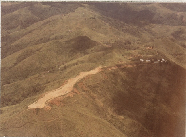
Talasea Airstrip is the brown patch to the right of the hill near mid-picture. Aircraft must divert left of the direct track visually, to avoid Garua Island's 922 feet peak, while manoeuvring to land on RWY 32.

Following successful conclusion of the approach procedure checks, the aircraft began to fly around the aerodrome’s Circling Area, to assess and confirm obstacles in that area. While crossing the approach path for RWY 33, I noted that pools of standing water were evident on the runway, suggesting some drainage issues that would have to be addressed.

Incredibly, there was enough dry runway that dust was kicked up by the application of reverse thrust on landing. This view, taken after landing and turning to taxy back to the apron, shows that the dust still hadn’t quite settled! It was still necessary to carefully avoid some pools of water along the runway, enroute to the terminal.

On the Job – Instrument Approaches Using Satellite Navigation Technology
I began designing the so-called GPS approaches in 2001, with the first charts for them being published in 2002. As with conventional instrument approaches, the designs for these procedures had to be thoroughly checked and validated in flight before they could be issued for publication. The following photos show just some of the successful results – and, no, I don’t intend showing you any of the failures!
I began designing the so-called GPS approaches in 2001, with the first charts for them being published in 2002. As with conventional instrument approaches, the designs for these procedures had to be thoroughly checked and validated in flight before they could be issued for publication. The following photos show just some of the successful results – and, no, I don’t intend showing you any of the failures!
These approaches have since become better known as RNAV(GNSS) approaches and are to become known as RNP procedures - a designation adopted by ICAO a few years ago.
Near the “Missed Approach Point” for the GPS Approach to RWY 14 at Kiriwina. The alignment isn’t quite right but still well within tolerances.
Near the “Missed Approach Point” for the GPS Approach to RWY 14 at Kiriwina. The alignment isn’t quite right but still well within tolerances.

Crawling along at the obstacle clearance level for the final approach segment of the GPS approach to RWY 22 at Buka.

Beyond the Missed Approach Point, at the obstacle clearance level for the Initial Missed Approach segment of the GPS approach to RWY 27 at Moro.

At MDA for the GPS approach to RWY 25 at Madang. The alignment isn’t quite right but within tolerances.

Approaching the Missed Approach Point for the GPS approach to RWY 14 at Kerema. This one is deliberately – and necessarily – offset, slightly, from the runway centreline.

Descending to MDA for the GPS approach to RWY 12 at Kikori.

Approaching the Missed Approach Point for the GPS approach to RWY 26 at Misima. This is yet another slightly offset final approach segment.

So that's the lot for this time around. I'm planning to provide another collection of photos at a later date. This one has taken long enough to produce and, doubtless, will take a while for those who are interested enough to view. Feel free to leave any comments that you think are likely to be appropriate.
Your photos are priceless! Thanks for sharing them. I have landed at many of the airstrips, including those at Waitope, Tapini, Ononge, and Fane, among others. Live in Goroka from June "86 thru Dec. '90, and loved every minute in PNG. By any chance, would you have an email address for the Catholic Mission at Ononge. My email is billwink69@gmail.com. I was in PNG with Helen Keller International.
ReplyDeleteThanks and take care!
Bill Winkley
I was a kid in NG during the 60s. I remember going to these places with Laurie Crowley (1920-2013) in VH-UNA and UNB. He would not land at Pomio. Ray Harris (1917-1997) flew us from PM to Lae via Tapini in 1964, in VH-CAC. He buzzed Tapini, then straight up the valley, to 13k ft, and to Lae. Rowan H.
ReplyDeleteAmazing collection....thanks so much for sharing. Mark Rhodes, Franair / Douglas Airways 1978 -1983 and Garamut/Vanair 1996.
ReplyDeleteA wonderful collection that brought back many memories - Kegsugl, Kagi, Bulolo etc. I particularly liked the photo of P2-ANQ outside Jacksons - I flew to the Trobriands on that aircraft in 1969.
ReplyDeleteI am currently putting together a sort of memoir of my time in PNG (1969-1979) and wonder if I could use that photo?
colinpain@gmail.com
Hello,
ReplyDeleteGreat pics and thanks for posting! I'm an airline guy in the U.S. who regularly gets to fly into some smaller strips in Southeast Alaska; well, small for a 737 anyway. But I've always loved this kind of flying. I've been having a blast lately as my sons discover Microsoft Flight Simulator and all the impressive scenery that is available these days. We've actually been messing with scenery for PNG, and I'm struck by how accurate it is compared to your photos. Thought you might find it fun to have a look:
https://orbxdirect.com/product/tap
https://orbxdirect.com/product/aypy
Thanks again!